Hire World's Best & Most Affordable Freelancers
Remote Sensing Freelancers in Indonesia
Truelancer is a curated freelance marketplace with thousands of top rated Remote Sensing Freelancers in Indonesia
Post your job effortlessly and receive quick quotes from our best Remote Sensing Freelancers in Indonesia
 50,000+ Happy Clients
4.8 Avg. Client Rating
Why Truelancer?
Access diverse global freelancers.
Smart Hire With AI Insights & Score.
100% Secured Payment & Safe Pay.
Quality work is our priority.
Hire Remote Sensing Freelancers in Indonesia and Experts
Find & Hire Remote Sensing in Indonesia who are professionals offering their expertise in various Freelance Remote Sensing Services to businesses near Indonesia and around the world. Indonesia is home to a large pool of talented and experienced Remote Sensing freelancers who can help businesses with professional Remote Sensing services in Indonesia. Freelance Remote Sensing services in Indonesia are quite affordable on our platform compared to hiring full-time employees.
Truelancer.com provides all types of Freelance Remote Sensing with a range of skilled and talented freelancers in Indonesia. We offer the opportunity to save 50% of your business cost by hiring Indonesia Remote Sensing freelancers.
Expert Remote Sensing freelancers for hire in Indonesia are skilled in using the latest Remote Sensing tools and techniques to deliver effective results for their clients for anytype of Remote Sensing jobs in Indonesia . With the help of Remote Sensing freelancers in Indonesia, businesses can get their work done quickly. Using Truelancer.com is 100% safe as the money is released to the freelancers after you are 100% satisfied with the work.
Popular Services from Remote Sensing Experts
Professionals offering Remote Sensing Services
Popular Tools used by Remote Sensing Experts
FILTERS
Only Pro Freelancers
SKILLS
COUNTRIES

it support engineer
installation lan cable, Mikrotik configuration,TCP/IP, proxy, DNS, Wifi configuration, Windows installation and troubleshooting, Macos installation and troubles...
$ 2/hr

Data Entry
I have skills in data processing using Ms. Excel and R. I have expertise in GIS, mapping, and remote sensing, especially in meteorology, climatology, and atmosp...
$ 2/hr

Geospatial Analyst
experienced in data analysis, data entry, spasial analyst
$ 10/hr
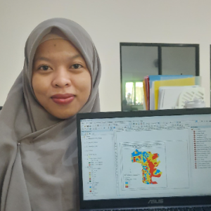
Data Analyst
As an experienced Data Analyst, I specialize in various types of statistical and spatial analysis. With a strong background in data processing and analysis, I c...
$ 15/hr

Bachelor Degree Of Engineering
Im a Surveyor and data processor. I have strong leadership and good communication with teamwork. Additionally, I have interest to the field of Geospatial Inform...
$ 20/hr
planner
final year students, have an interest in spatial planning and analysis, and are willing to learn new things. Have good analytical, communication, collaboration...
$ 30/hr
Data Analyst | GIS Specialist
Holds a Bachelors degree in Forestry with a major in Forest Management from Universitas Gadjah Mada. Experienced in GIS & Remote Sensing, general plantation man...
$ 5/hr

Undergraduate Geodetic Engineer
As a Geodesy Engineering student, I excel in communication, leadership, and teamwork. Im dedicated to ongoing learning, and honing my skills in surveys and mapp...
$ 30/hr
Bachelor of Forestry, Spatial Data Analyst
Spatial Data Analyst GIS Remote Sensing
$ 5/hr
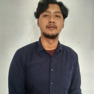
GIS & Remote Sensing Specialist |Spatial Data Analys |Image Processing
I am Sena Ramadhoni Sulistiyo. I come from Yogyakarta, Indonesia. Ive graduated from 3 years Degree of Remote Sensing And GIS at Gadjah Mada University. Spatia...
$ 18/hr
Hiring Information for Remote Sensing Experts
When hiring Remote Sensing experts, prioritize candidates with strong skills in satellite image analysis, GIS integration, and environmental monitoring. Look for portfolios demonstrating proficiency in tools like ERDAS Imagine, ENVI, and Google Earth Engine, alongside measurable outcomes such as land cover classification accuracy or disaster impact assessments. Clear project scoping and onboarding are essential to align expectations on data sources, processing workflows, and deliverables. Candidates with experience in hyperspectral imaging and LiDAR data interpretation add significant value for specialized applications.
Hourly Rates of Remote Sensing Experts
Remote Sensing professionals command higher freelance rates in North America and Oceania, typically ranging from USD 50 to 90 per hour, reflecting strong demand for satellite image analysis and environmental monitoring expertise. Western Europe offers competitive rates between USD 45 and 80, while Eastern Europe and Latin America provide more cost-effective options at USD 25 to 55. South Asia and Southeast Asia have lower hourly rates, generally USD 15 to 40, suitable for clients seeking budget-friendly geospatial data processing services. The rates vary based on specialization in hyperspectral imaging, LiDAR interpretation, and GIS integration.
Job Opportunities for Remote Sensing Experts
Remote Sensing professionals find opportunities across environmental consulting, agriculture, urban planning, and disaster management industries. Freelancing and remote roles are increasingly common, leveraging cloud analytics platforms and open-source GIS tools. Mastery of software like ArcGIS, QGIS, and SNAP enhances employability. With growing demand for satellite data analysis and geospatial modeling, skilled practitioners can command competitive earnings globally. Continuous learning in emerging sensor technologies and spatial data science expands career prospects in this dynamic field.
Tools & Platforms for Remote Sensing Experts
ERDAS Imagine and ENVI dominate the remote sensing software market, offering comprehensive image processing and analysis capabilities. ArcGIS and QGIS provide robust GIS integration, while Google Earth Engine leads in cloud-based geospatial analytics. Emerging tools like SNAP and open-source Python geospatial libraries are gaining traction for flexible, cost-effective workflows. This diverse tool ecosystem supports a wide range of remote sensing applications, from environmental monitoring to precision agriculture, ensuring professionals have access to both industry-standard and innovative platforms.
How Hiring Works on Truelancer

Post a Job
Share Prerequisites
Share requirements for you job - what, when & how you want it done.

Get Proposals
Pick The Right One
Relax as freelancers pitch to you; choose the perfect one for your project.

Connect Easily
Direct Communication
Talk directly with freelancers, clarify details, and keep projects running without any hassle.

Award & Pay
Your Project, Your Rules
Award confidently, pay securely. Truelancer's Security Deposit ensures refunds if unsatisfied.

Safe Payments
Pay When Satisfied
Release funds only when 100% satisfied for secure, approved transactions.


Copyright © 2026 | Truelancer.com